
In late November, the Seattle Times published an article outlining the creation of a series of hikes in the metropolitan Seattle area. (Note the Times content is stored behind a paywall so I will not link it here). These hikes were created by The Mountaineers, a well-known hiking organization. The appeal of the hikes, the commonality, was that they connected parks designed in the early 1900s by the famous Olmsted family (designers of Central Park among other jewels). The Mountaineers decided to use the Ballard Locks and Rainier Beach as its anchor points and then created five sections, each totaling about 10k distance. In addition, within each 10k section there were two parts, allowing for 1-hour hikes for most people. They posted detailed explanations of each segment, filled with historical anecdotes and things to watch for. Embedded within these notes were directions on how to proceed. It made for both delightful and, at times, frustrated reading. The details can be found at https://www.mountaineers.org/activities/routes-places/seattle-olmsted-50-ballard-locks-to-rainier-beach
A GPX (GPS Exchange) file is located at the site which can be downloaded to your smartphone mapping software., in my case Gaia. The combination of both the GPX route and paper instructions turned out to be vital. It’s probably fair to say that the Mountaineers goal was to appease the large community of day hikers who wanted ideas for afternoon strolls. Little did they know that there exists a strangely-wired ultrarunning community looking for day-long adventures to run. And with the mountains already dusted with snow and sleet, an urban challenge was ripe for the taking. And so I decided on this, the shortest day of the year, to tackle the entire five section, 50k “trail” in its entirety. It turns out that I started the day at sunrise in Ballard and, sure enough, ended the day right at sunset in Rainier Beach. But it’s what happened in between that matters.
Section 1 (Ballard Locks to Woodland Park Zoo)
Before diving into the course, a bit on preparations. It was a somewhat chilly 45 degrees at the start, with a cloudy but dry day forecasted. For me that is perfect conditions. I wore a long sleeve shirt and had my lightweight rain jacket balled up in my Nathan backpack. I started with a liter of water and 3 snack bars (which was all I would need – there were plenty of stores along the way). The course had some climbing, but it was almost entirely asphalt so I left my poles in the car. Finally, I parked just outside the Ballard Locks in a PayByPhone lot which had a 4 hour limit – I tried to extend midday but it wouldn’t allow for that, even though the lot was almost entirely empty. I didn’t get a ticket but it’s something to think over.
The first route starts along the beautiful Shilshole Bay and is a nice way to begin the day. For those of you who enjoyed the Seattle Locks Marathon in the past, this is the end portion of the out and back. The asphalt trail continued into Golden Gardens, and the first of what would be over a dozen park playgrounds of the day. After a brief rest to enjoy the view, the first challenge awaited – 290 steps up to the residential world above. There are a few landing areas to break up the routine, but I simply plowed through them and reached the summit – a compacted community which spanned many blocks and had cafes and bakeries. I peered in at Larsson’s Bakery but decided to continue on. The next few miles were similar as I moved over to Greenwood and the Phinney Ridge area. The houses were packed tight and the streets fairly narrow. Eventually Phinney spits you over to the gates of the Woodland Park zoo. I was about 1.5 hours into my adventure and had completed the first section.


Section 2 – Woodland Park Zoo to UW
After running along the Zoo fence line for a bit I needed to find the pedestrian bridge over the heavily trafficked Aurora Ave. It’s a bit further south than the GPS tracker indicated but easy to see (another hint: stay up top on the trail and do not go down to sidewalk along the road). This sends you into one of the many parks along Green Lake Road. I was somewhat familiar with the area, having run around Green Lake, a Seattle go-to, many times. The course had us down close to the lake (vs. the sidewalk up top) and there were quite a few people out exercising and enjoying the day. We traversed the southeast section from about 7 o’clock up to about 2 o’clock (if looking at the lake on a map), escaping at Greg’s Cycle store and over to a long stretch on Ravenna Blvd. This led us into our next treasure, Cowen Park, which was a wonderful discovery for me.

The area was long and narrow but quiet and very green. I spent the entire time rotating my head from left to right at the hillsides. Suddenly, an aqua green bridge in Art Deco style (1936) appeared above me. And if that wasn’t enough five minutes later the Ravenna Park bridge (1913) was even more spectacular. We climbed up probably 100-200 feet on a few switchbacks and then got to cross over that bridge, which was blocked off from vehicles. On the other side was one of the only sketchy points where we descended back down to another trail – it was pretty steep with not great footing, but I managed to stay vertical. My reward was in front of me – two fairly long wooden pedestrian bridges.
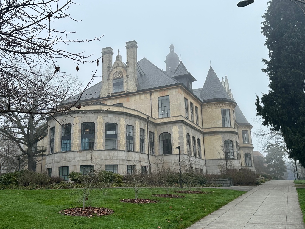
Leaving the park, we returned to Ravenna Blvd for a short while before entering a line of Fraternity Row houses of UW. Large, cemented edifices in classical style adorned both sides of the street and brought me to the entrance of the UW campus. It had been a couple of years since I visited the center of activity and even on a cloudy gray day it impressively surrounded me with its sheer size and importance. I found my way over to the Quad and eventually over to the Drumheller Fountain which looks southeast towards Mt. Rainier. It was here at this site on a spring day in 1988 that I decided to move to Seattle one day. It would take a job change and 6 years to fulfill that dream. Breaking from my momentary nostalgic outburst, I proceeded another 400 yards which took me over by Husky Stadium having completed the 2nd section.

Section 3 – UW to Arboretum (with visit to Capitol Hill)
I made my way across the Montlake Bridge, trying to remember the last time I had actually walked across the bridge – no doubt years in the past. Below was the narrow passage where rowing events took place – UW possessing a rich history in this sport. There was barely 50 yards separating the sides, which were filled with collegiate signage. I ambled down the steps and followed the path eastward a few hundred yards to where a bridge extended out to Marsh Island. This again was a new experience. The metal boardwalks were bent and a bit wobbly but along with a few other people I made my way across the island filled with marsh grass. The 520 highway roared close by.

Marsh Island then connected to Foster Island which was more of the same look, small but quite rustic and a bit out of place given all of the concrete in place on many sides. The instructions said there was a tunnel underneath 520 which I found hard to believe until I walked through a tunnel underneath 520. This path leads, in short order, over towards the stunning and huge Arboretum, also Olmsted-designed.
I trotted through the Arboretum, somewhat aimlessly because the exit was a mile or so away and was a straight path on the Azalea Trail. After exiting the gardens, crossing Madison, and continuing along Lake Washington Blvd I noticed the instruction on the paper did not line up with my location. Suddenly, I realized that I had skipped a 2 mile-ish out and back to Capitol Hill! My phone map was correct in that I was on the right trail, just that I had overlooked the out and back loop that proceeded. Yikes! That was about a 1 mile, 15 min mistake. I was still more or less on track (4 mph) so didn’t panic too much as I climbed back up the Lake Washington Blvd hill I had just been plummeting down. After meandering over and past the Japanese Gardens I found Boyer Ave and climbed up to Interlaken Park, another pleasant surprise. I took the path on the right – it was probably less than a mile before circling up and out of the park and started my way around a large cemetery. I was making decent time on the streets here and quickly found my way to Volunteer Park and more magic.
First there was a gated reservoir surrounded by a trail – much like the Jackie Onassis Reservoir in Central Park. I wanted to run around and around it – probably only a quarter mile at most – but the paper instructions guided me to a water tower at Capitol Hill that I was to climb. Say what? It took me a minute or so to find the tower hidden amidst some protective pines. Inside looked a bit old and rusty but I climbed the 107 steps to the top where there is a museum like exhibit set up on the circular, outside wall. In addition, there were windows with chicken wire cover allowing you to see out. And immediately I located the Space Needle and Seattle skyline bursting up. Despite the cloudy day it was still a stellar view. After a few minutes poking around the Olmsted exhibit, I made my way down and over towards the Seattle Asian Art Museum (so that’s where that is) and said hello to the William Seward statue (thank you for Alaska).

The trip back to the Arboretum was a bit anticlimactic as I worked my way back on the other side of Interlaken Park and then down Lake Washington (again) to the Japanese Gardens. It was nearly 1:00pm and I still had a healthy half marathon to complete.
Section 4: Arboretum to Stan Sayres
The course moved back over to water as we traversed Lake Washington Blvd. There are nine Olmsted parks dotting the shoreline – obviously this land is worth millions but the parks remain. I went back across the road to check out Viretta Park where a bench is loaded with vases of flowers and momentos in honor of Kurt Cobain from Nirvana. Somehow, I passed on by Howell Beach which is known as the “nudist” beach and then moved through Madrona Beach and on to Leschi where we crossed over into the park and climbed up and over streets, up and over streets to the stunning Mt. Baker Viewpoint. And then we went right back down to the shoreline sneaking through Colman Park. I was beginning to tire some, the sun was moving its way down, yet there remained some unfinished business.

Section 5: Stan Sayres to Rainier Beach
I was on familiar ground here, as this section of Lake Washington Blvd is part of the Seattle Ghost Marathon, run on the Saturday after Thanksgiving. It was pretty easy going, although the hazardous sidewalks are in need of repair. I made my way into Seward Park and was looking forward to taking the short cut up the Seward Park Rd vs. the Shore Loop Rd which I’ve always taken. I turned around to take a picture of the Torii Gate at the entrance and my phone died. It had been losing power throughout the day – my bad on listening to music and keeping bluetooth operating the previous 6+ hours. So that left me at the mercy of the paper instructions. No problem – up the road and over to the Bald Eagle Trail and then Sqabaqsed Trailhead. I read that and assumed I need to then get on the Sqabasqsed Trail and kept moving…and moving… and more and more until I realized I was heading back northwest toward the Shore Loop Rd. Arghh!! That added another bonus mile and was a mental setback for a few minutes until I realized I had to keep going to beat the sunset.

Leaving Seward Park and going south was somewhat new – I had biked over here a few times but was not remembering much. I passed the pristine, gated home of the Raisbecks (with a million dollar statue in the front lawn) and finally got to S Grattan St and the spur down to Pritchard Island Beach, which was no longer an island once they lowered Lake Washington by 9 feet in 1916. After a brief reprise to take in the view I realized the next set of instructions was a bit murky – the Be’er Sheva Park was next, but it was on the other side of a large nursery which was gated off due to construction. The instructions mentioned this, and I did my best to decipher how to get over to the park on the other side, sneaking over on an alley street heading back up the hill to Seward Park Ave. Dusk was beginning to fall as I made my way through the park to S Henderson St, my last turn of the day. Rainier Beach High School, on my right, is under a massive $300 million reconstruction. Next up was to cross over the busy Rainier Ave S to the Community Center and Playfield. It wasn’t clear to me where to stop the watch – unlike races there was no finish line. I touched one of the park signs and finished my Olmsted 50k journey in 8:27, meaning I started the day exactly at sunrise 7:54 and finished at sunset 4:20 – not by design. (For those Ladyhawke fans out there, that’s a close call before I turn into a wolf, right?)
Closing Observations
Many will try this with a friend and place a car at each point for the return trip. Going solo, once my phone died, I knew Uber wasn’t an option. I waited around for a cab to pass but after 5 mins gave up on that option. Luckily for me there is a bus stop right at the intersection of Rainier Ave S and S Henderson St at the corner with the Rite Aid. That is the home for the Rt 7 bus to Downtown Seattle (hurrah!). It cost me $1 and I stayed on to the King St station where I knew there would be cabs. 15-20 mins later I was back at Ballard Locks and my (unticketed) car. Some days the cards fall your way.
Overall, I give this urban adventure high grades. It’s a lot of asphalt and a fair amount of climbing (up/down) – I showed 2,900 ft. There are numerous self-serve “aid stations” along the way, but the density of those decreases in the second half. The parks are the star of the day – beautifully laid out and most in very good shape and in good use to this day. The supporting cast of monuments, bridges, statues, museums, and much more distract you from the physical activity. There are no severe traffic issues – there are crosswalks all along the way and its helpful to use them vs. going rogue. I had a cloudy, foggy day – on a sunnier day this would be even more tremendous a route. As the Mountaineers pages advertise, try a section here or there and see if it works for you. For me, I’m likely to try it again – most likely on December 21st next year – the shortest day of the year – making this challenge worth the entry fee and more.


